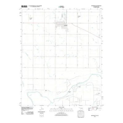
2010 Map of Grandfield
USGS Topo · Published 2010About this map
Grandfield serves as the central hub of this Oklahoma-Texas borderlands survey, situated amidst a landscape shaped by both agriculture and petroleum extraction. The town's grid is flanked by the Grandfield Municipal Airport to the west and the Grandfield Cemetery to the north, while the surrounding plains are etched with an extensive network of range and section roads. The southern portion of the map is dominated by the meandering course of the Red River, which defines the state boundary. Here, the Northwest Oil Field and Red River Oil Field indicate the region's industrial character, with numerous well sites scattered across the river bottom. Seasonal drainage is provided by Blue Creek and Curtis Creek, which flow toward the river's wide, sandy bed and landmarks like Burke Bet Island. This map documents a modern prairie landscape where local aviation and oil production intersect with the traditional cattle and farming routes of Tillman County.
Find a feature on this map
29 named features on this map. Tap any name to fly to it.
Don’t see what you’re looking for? This feature index may not catch every label — zoom into the map to look around manually.
Map Details
Editions of this 2010 Grandfield Map
This is the sole edition of this map. No revisions or reprints were ever made.
Other maps of this area

1915 · Clara
USGS Topo · 1:24,000

1915 · Barwise School
USGS Topo · 1:24,000

1915 · Burkburnett
USGS Topo · 1:24,000

1918 · Buckburnett
USGS Topo · 1:31,680

1918 · Barwise School
USGS Topo · 1:31,680

1918 · Clara
USGS Topo · 1:31,680

1955 · Lawton
USGS Topo · 1:250,000

1957 · Burkburnett
USGS Topo · 1:62,500

1958 · Electra
USGS Topo · 1:62,500

1962 · Chattanooga
USGS Topo · 1:62,500