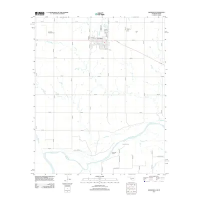
2012 Map of Grandfield
USGS Topo · Published 2012About this map
The town of Grandfield anchors this landscape in Tillman County, situated near the winding southern border defined by the Red River. The community's grid is clearly delineated, featuring named thoroughfares like S Main St and W Orth St, and is flanked by the Grandfield Municipal Airport to the northwest. Local history is deeply connected to the land's burial grounds, including Grandfield Cem and Eschiti Cem, which serve as vital landmarks for genealogists.
Find a feature on this map
48 named features on this map. Tap any name to fly to it.
Don’t see what you’re looking for? This feature index may not catch every label — zoom into the map to look around manually.
Map Details
Editions of this 2012 Grandfield Map
This is the sole edition of this map. No revisions or reprints were ever made.
Other maps of this area

1915 · Clara
USGS Topo · 1:24,000

1915 · Barwise School
USGS Topo · 1:24,000

1915 · Burkburnett
USGS Topo · 1:24,000

1918 · Buckburnett
USGS Topo · 1:31,680

1918 · Barwise School
USGS Topo · 1:31,680

1918 · Clara
USGS Topo · 1:31,680

1955 · Lawton
USGS Topo · 1:250,000

1957 · Burkburnett
USGS Topo · 1:62,500

1958 · Electra
USGS Topo · 1:62,500

1962 · Chattanooga
USGS Topo · 1:62,500