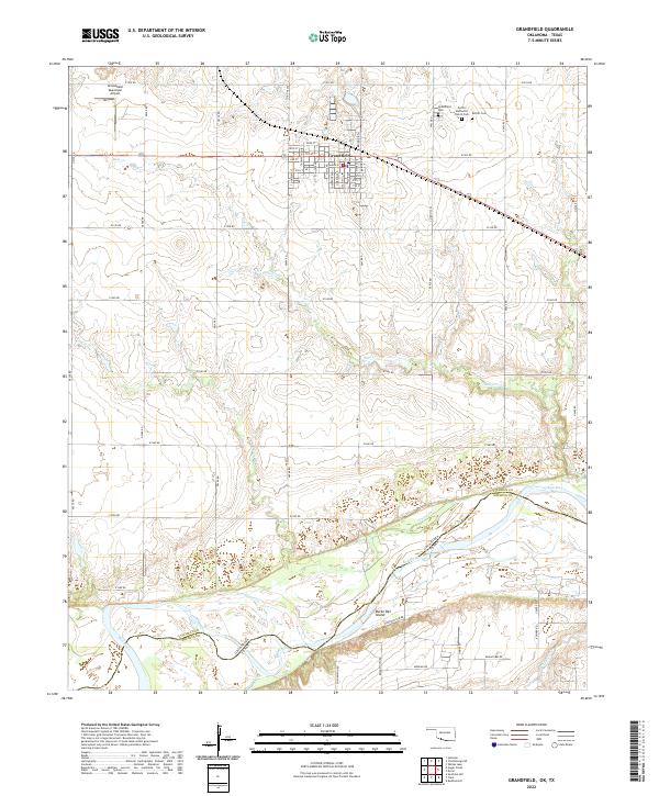
2022 Map of Grandfield
USGS Topo · Published 2022About this map
Grandfield serves as the focal point of this southwestern Oklahoma landscape, positioned just north of the winding Red River corridor at the Texas border. The town is laid out on a systematic grid including Main St and 1st St, supported by the Grandfield Municipal Airport to the northwest. Significant genealogical landmarks are found on the outskirts, notably the Eschiti Methodist Church and the adjacent Eschiti Cem, which preserve the name of a settlement that predated or merged with the modern townsite. The topography is defined by drainage systems like Bule Creek and Curtis Cr that flow toward the river bottom. Near the state line, Burke Bet Island sits within the complex river channel, highlighting the shifting nature of the boundary between Oklahoma and Texas. The surrounding landscape is crisscrossed by a dense network of section-line roads, such as e1910 RD and Bridge Rd, reflecting a region deeply rooted in organized agricultural production.
Find a feature on this map
64 named features on this map. Tap any name to fly to it.
Don’t see what you’re looking for? This feature index may not catch every label — zoom into the map to look around manually.
Map Details
Editions of this 2022 Grandfield Map
This is the sole edition of this map. No revisions or reprints were ever made.
Other maps of this area

1915 · Clara
USGS Topo · 1:24,000

1915 · Barwise School
USGS Topo · 1:24,000

1915 · Burkburnett
USGS Topo · 1:24,000

1918 · Buckburnett
USGS Topo · 1:31,680

1918 · Barwise School
USGS Topo · 1:31,680

1918 · Clara
USGS Topo · 1:31,680

1955 · Lawton
USGS Topo · 1:250,000

1957 · Burkburnett
USGS Topo · 1:62,500

1958 · Electra
USGS Topo · 1:62,500

1962 · Chattanooga
USGS Topo · 1:62,500