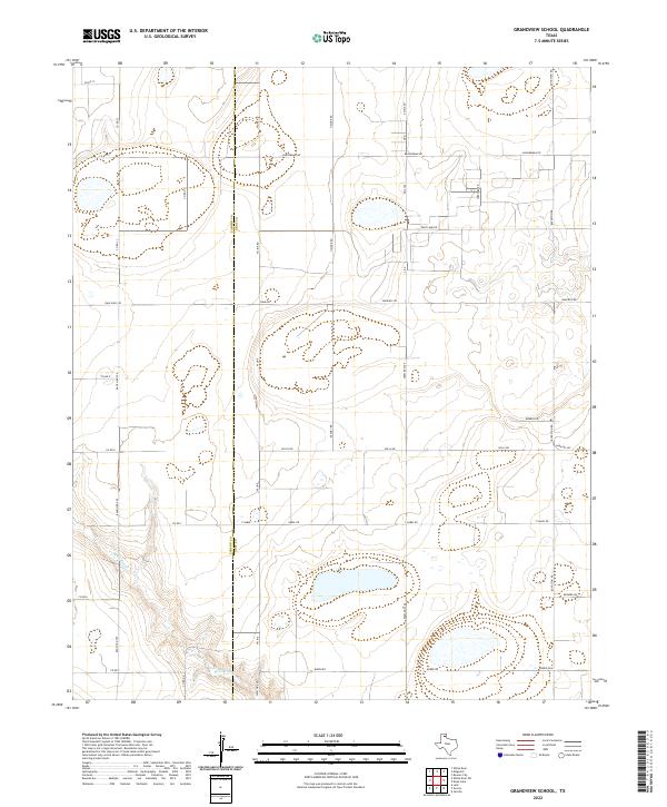
2022 Map of Grandview School
USGS Topo · Published 2022About this map
McClellan Cr meanders across the southwestern portion of this landscape, carving a distinct drainage pattern through the High Plains. The area is defined by a rigorous grid of section lines and rural thoroughfares that straddle the Carson Co and Gray Co boundary. This 2022 survey illustrates a region dominated by ranching and agricultural infrastructure, where family-named roads like Baggerman Rd, Haiduk Rd, and Keahey Rd provide access to remote acreage. The presence of several ephemeral water features and the naming of Deep Lake Rd suggest the importance of surface water management in this arid environment. Key transportation corridors, including Farm Rd 293 and Ranch Rd 295, connect the various pastures and properties, maintaining the rural character of the Panhandle.
Find a feature on this map
36 named features on this map. Tap any name to fly to it.
Don’t see what you’re looking for? This feature index may not catch every label — zoom into the map to look around manually.
Map Details
Editions of this 2022 Grandview School Map
This is the sole edition of this map. No revisions or reprints were ever made.
Other maps of this area

1954 · Amarillo
USGS Topo · 1:250,000

1958 · Amarillo
USGS Topo · 1:250,000

1960 · Groom
USGS Topo · 1:62,500

1964 · Jericho
USGS Topo · 1:24,000

1965 · White Deer
USGS Topo · 1:24,000

1966 · Grandview School
USGS Topo · 1:24,000

1966 · White Deer SW
USGS Topo · 1:24,000

1966 · Kingsmill
USGS Topo · 1:24,000

1966 · Bowers City
USGS Topo · 1:24,000
1968 · Deep Lake
USGS Topo · 1:24,000