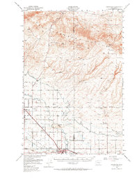
1950 Map of Grandview
USGS Topo · Published 1964About this map
The Yakima Valley unfolds as a meticulously engineered agricultural landscape in this mid-century survey, defined by the critical irrigation infrastructure of the Sunnyside Canal and the Roza Canal. These waterways enabled the development of the valley floor, supporting settlements like Grandview and Sunnyside that grew alongside the dual steel corridors of the Northern Pacific and Union Pacific railroads. The map captures the contrast between the fertile, organized valley floor and the high, arid terrain of the Rattlesnake Hills to the north, which remain dotted with numerous springs such as Railroad Spr and Maiden Spr. Notable local landmarks of the era include the Sunnyside Municipal Airport and the Lower Valley Country Club, while smaller rail-side locations like Lichty and Forsell mark the rural shipping points of the day.
Find a feature on this map
33 named features on this map. Tap any name to fly to it.
Don’t see what you’re looking for? This feature index may not catch every label — zoom into the map to look around manually.
Map Details
Editions of this 1950 Grandview Map
2 editions found

Other maps of this area

1910 · Zillah
USGS Topo · 1:125,000

1915 · Prosser
USGS Topo · 1:125,000

1916 · Coyote Rapids
USGS Topo · 1:62,500

1917 · Priest Rapids
USGS Topo · 1:62,500

1917 · Prosser
USGS Topo · 1:125,000

1936 · Hog Ranch Buttes
USGS Topo · 1:48,000

1941 · Black Rock Spring
USGS Topo · 1:62,500

1948 · Cairn Hope Peak
USGS Topo · 1:24,000

1948 · Emerson Nipple
USGS Topo · 1:24,000

1950 · Yakima
USGS Topo · 1:250,000