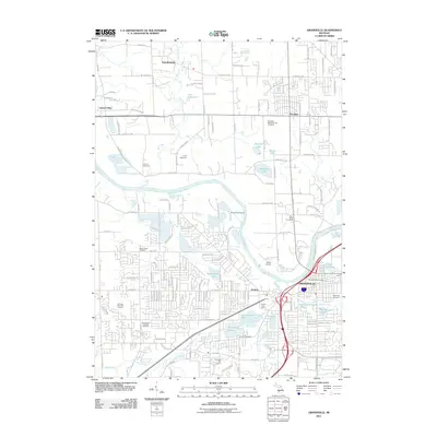
2011 Map of Grandville
USGS Topo · Published 2011About this map
The Grand River serves as the central artery for this portion of West Michigan, winding through a landscape transitioning from the suburban edges of Grandville and Jenison into more open terrain. The mapping detail shows a dense network of residential development and industry, particularly along the Rush Creek and Buck Creek corridors. Genealogy and local history researchers will find several significant burial grounds, including Rosedale Memorial Park Cemetery, Wyoming Cemetery, and the Georgetown Township Cemetery. Aviation and recreational sites are well-documented, from the riverside Riverview Airport and Weller Airport to local social hubs like Camp Spikehorn and the Gleneagle Golf Course. Numerous inland water bodies such as Maplewood Lake and Indian Spring Lake dot the map, illustrating the post-glacial topography and its influence on modern neighborhood layouts and drainage patterns west of Grand Rapids.
Find a feature on this map
141 named features on this map. Tap any name to fly to it.
Don’t see what you’re looking for? This feature index may not catch every label — zoom into the map to look around manually.
Map Details
Editions of this 2011 Grandville Map
This is the sole edition of this map. No revisions or reprints were ever made.
Other maps of this area

1914 · Grand Rapids
USGS Topo · 1:62,500

1918 · Cedar Springs
USGS Topo · 1:62,500

1943 · Cedar Springs
USGS Topo · 1:62,500

1943 · Grand Rapids
USGS Topo · 1:62,500

1945 · Ravenna
USGS Topo · 1:62,500

1954 · Midland
USGS Topo · 1:250,000

1958 · Midland
USGS Topo · 1:250,000

1958 · Allendale
USGS Topo · 1:24,000

1958 · Grandville
USGS Topo · 1:62,500

1958 · Grandville
USGS Topo · 1:24,000