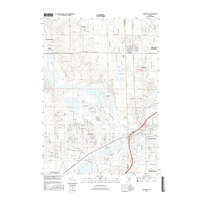
2017 Map of Grandville
USGS Topo · Published 2017About this map
The Grand River snakes through this 2017 study of the western Grand Rapids metropolitan area, marking the boundary between Walker and the burgeoning suburbs of Jenison and Grandville. The landscape reveals a sophisticated network of residential expansion and preserved open space, anchored by major landmarks like Johnson Park Sw and the extensive grounds of Rosedale Memorial Park Cem. The presence of small aviation facilities like Riverview Airport and Weller Airport alongside the heavy transit corridor of Chicago DR illustrates the varied infrastructure supporting the region's growth. For genealogists and local historians, several burial grounds including Jenison Cem and Georgetown Township Cem provide clear anchor points for tracing family settlement patterns across the Ottawa Co and Kent Co line. The map also details the complex drainage of the river basin, featuring numerous tributaries such as Rush Cr, Buck Cr, and Sand Cr.
Find a feature on this map
246 named features on this map. Tap any name to fly to it.
Don’t see what you’re looking for? This feature index may not catch every label — zoom into the map to look around manually.
Map Details
Editions of this 2017 Grandville Map
This is the sole edition of this map. No revisions or reprints were ever made.
Other maps of this area

1914 · Grand Rapids
USGS Topo · 1:62,500

1918 · Cedar Springs
USGS Topo · 1:62,500

1943 · Cedar Springs
USGS Topo · 1:62,500

1943 · Grand Rapids
USGS Topo · 1:62,500

1945 · Ravenna
USGS Topo · 1:62,500

1954 · Midland
USGS Topo · 1:250,000

1958 · Midland
USGS Topo · 1:250,000

1958 · Allendale
USGS Topo · 1:24,000

1958 · Grandville
USGS Topo · 1:62,500

1958 · Grandville
USGS Topo · 1:24,000