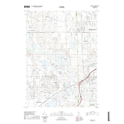
2019 Map of Grandville
USGS Topo · Published 2019About this map
The Grand River carves a winding path through this western Michigan landscape, serving as a natural boundary for the growing communities of Jenison, Walker, and Grand Rapids. The area exhibits a blend of established residential neighborhoods and aviation infrastructure, with both Riverview Airport and Weller Airport positioned along the river's banks. For those tracing family histories, the map is particularly rich in burial grounds, featuring the large Rosedale Memorial Park Cem and several local sites like Jenison Cem and the Georgetown Township Cem. Significant water features such as Fennessy Lake and Round Lake punctuate the terrain north of the river, while the southern reach is defined by the convergence of Rush Cr and Br Rush Cr near Hudsonville.
Find a feature on this map
235 named features on this map. Tap any name to fly to it.
Don’t see what you’re looking for? This feature index may not catch every label — zoom into the map to look around manually.
Map Details
Editions of this 2019 Grandville Map
This is the sole edition of this map. No revisions or reprints were ever made.
Other maps of this area

1914 · Grand Rapids
USGS Topo · 1:62,500

1918 · Cedar Springs
USGS Topo · 1:62,500

1943 · Cedar Springs
USGS Topo · 1:62,500

1943 · Grand Rapids
USGS Topo · 1:62,500

1945 · Ravenna
USGS Topo · 1:62,500

1954 · Midland
USGS Topo · 1:250,000

1958 · Midland
USGS Topo · 1:250,000

1958 · Allendale
USGS Topo · 1:24,000

1958 · Grandville
USGS Topo · 1:62,500

1958 · Grandville
USGS Topo · 1:24,000