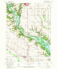
1965 Map of Granger
USGS Topo · Published 1966About this map
Saylorville Reservoir dominates this mid-1960s landscape, illustrating the controlled inundation of the Des Moines River valley across the borders of Boone, Dallas, and Polk counties. The map preserves the location of small crossroads and rail-oriented settlements such as Zook Spur, High Bridge, and Gibbsville before modern suburban expansion fully reached the area. The presence of Granger Homesteads and the town of Granger reflect the agricultural and communal planning of the region, while industrial remnants like mine dumps and gravel pits suggest a history of resource extraction alongside the river. Family and community history is anchored by several burial grounds, including Elk Rapids Cem and Mt Hope Cem, and the rural Hopkins Grove Ch, offering a detailed view of Central Iowa’s social geography during a period of major hydrological change.
Find a feature on this map
52 named features on this map. Tap any name to fly to it.
Don’t see what you’re looking for? This feature index may not catch every label — zoom into the map to look around manually.
Map Details
Editions of this 1965 Granger Map
2 editions found
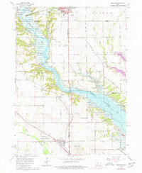
Other maps of this area

1905 · Des Moines
USGS Topo · 1:62,500

1907 · Des Moines
USGS Topo · 1:62,500

1908 · Waukee
USGS Topo · 1:62,500

1911 · Madrid
USGS Topo · 1:62,500

1911 · Slater
USGS Topo · 1:62,500

1913 · Slater
USGS Topo · 1:62,500

1914 · Madrid
USGS Topo · 1:62,500

1954 · Des Moines
USGS Topo · 1:250,000

1956 · Des Moines
USGS Topo · 1:250,000

1956 · Des Moines NW
USGS Topo · 1:24,000