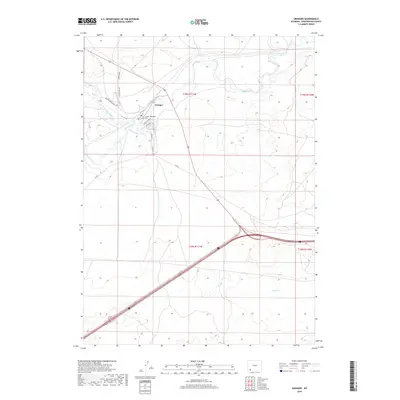
2018 Map of Granger
USGS Topo · Published 2018About this map
The confluence of Hams Fork and Blacks Fork anchors the small settlement of Granger, positioned at a vital crossroads in the high desert landscape. This area has long served as a corridor for travel and ranching, evidenced by the presence of Old US Hwy 30 and the local grid comprising streets like 1st St and Spruce St. The topography is defined by the winding paths of these waterways through the dry terrain, including the more isolated Spider Cr to the south. Local history is physically represented by the Granger Municipal Cem located just north of the town center. While modern infrastructure like Interstate 80 cuts across the southern portion of the quadrangle, the map maintains a record of older ranching access routes such as Bluemell Ranch RD and Co Rd 16.
Find a feature on this map
18 named features on this map. Tap any name to fly to it.
Don’t see what you’re looking for? This feature index may not catch every label — zoom into the map to look around manually.
Map Details
Editions of this 2018 Granger Map
This is the sole edition of this map. No revisions or reprints were ever made.
Other maps of this area

1954 · Ogden
USGS Topo · 1:250,000

1954 · Rock Springs
USGS Topo · 1:250,000

1958 · Ogden
USGS Topo · 1:250,000

1958 · Rock Springs
USGS Topo · 1:250,000

1960 · Ogden
USGS Topo · 1:250,000

1961 · Blue Point
USGS Topo · 1:24,000

1961 · Little America
USGS Topo · 1:24,000

1961 · Sevenmile Gulch
USGS Topo · 1:24,000

1961 · Granger
USGS Topo · 1:24,000

1962 · Rock Springs
USGS Topo · 1:250,000