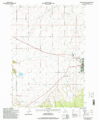
1995 Map of Grangeville West
USGS Topo · Published 1999About this map
Grangeville serves as the focal point of this mid-1990s landscape, positioned at the edge of the Camas Prairie where the high plateau begins to break toward the canyon lands. The map illustrates a developed agricultural and civic hub, featuring the Grangeville Golf and Country Club, a local High School, and a Communication Tower near the town center. To the north, the small settlement of Denver sits amidst a network of drainage systems including the South Fork Cottonwood Creek, while the western terrain is marked by the distinct basin of Tolo Lake.
Find a feature on this map
19 named features on this map. Tap any name to fly to it.
Don’t see what you’re looking for? This feature index may not catch every label — zoom into the map to look around manually.
Map Details
Editions of this 1995 Grangeville West Map
This is the sole edition of this map. No revisions or reprints were ever made.
Other maps of this area

1924 · Kamiah
USGS Topo · 1:125,000

1955 · Pullman
USGS Topo · 1:250,000

1955 · Grangeville
USGS Topo · 1:250,000

1958 · Pullman
USGS Topo · 1:250,000

1959 · Grangeville
USGS Topo · 1:250,000

1963 · Goodwin Meadows
USGS Topo · 1:24,000

1963 · Grangeville West
USGS Topo · 1:24,000

1963 · White Bird Hill
USGS Topo · 1:24,000
1963 · Grangeville East
USGS Topo · 1:24,000

1963 · White Bird
USGS Topo · 1:24,000