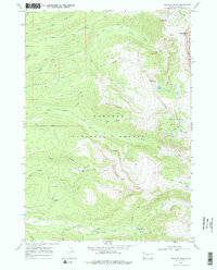
1968 Map of Granite Basin
USGS Topo · Published 1972About this map
The high-altitude drainage systems of Targhee National Forest and the western edge of Grand Teton National Park define this 1968 topographic study. The landscape is characterized by a series of prominent ridges, including Commissary Ridge and Dry Ridge, which separate deep canyons carved by North Leigh Creek and South Leigh Creek. The presence of the Grand Targhee Resort, complete with its Parking Area and Ski Lift system on the slopes of Freds Mountain, shows the area's mid-century development as a recreational destination.
Find a feature on this map
42 named features on this map. Tap any name to fly to it.
Don’t see what you’re looking for? This feature index may not catch every label — zoom into the map to look around manually.
Map Details
Editions of this 1968 Granite Basin Map
3 editions found
Other maps of this area

1899 · Grand Teton
USGS Topo · 1:125,000

1901 · Grand Teton
USGS Topo · 1:125,000

1943 · Driggs
USGS Topo · 1:62,500

1946 · Driggs
USGS Topo · 1:62,500

1955 · Driggs
USGS Topo · 1:250,000

1958 · Driggs
USGS Topo · 1:250,000

1962 · Driggs
USGS Topo · 1:250,000

1965 · Mc Renolds Reservoir
USGS Topo · 1:24,000

1965 · Clawson
USGS Topo · 1:24,000
1968 · Granite Basin
USGS Topo · 1:24,000