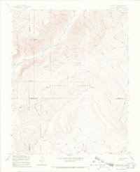
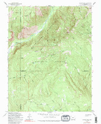
1964 Map of Granite Peak
USGS Topo · Published 1968About this map
Tuckerville and the high country of the San Juan National Forest define this landscape along the triple boundary of Hinsdale, La Plata, and Archuleta counties. The Los Pinos River carves through the center of the quadrangle, flanked by prominent summits like Graham Peak and Three Sisters Peaks. The map records the infrastructure of the mid-century wilderness economy, notably the Pine-Piedra Stock Driveway and several other stock driveways and pack trails that connected high-altitude grazing lands.
Find a feature on this map
44 named features on this map. Tap any name to fly to it.
Don’t see what you’re looking for? This feature index may not catch every label — zoom into the map to look around manually.
Map Details
Editions of this 1964 Granite Peak Map
5 editions found
Other maps of this area

1900 · Needle Mountains
USGS Topo · 1:62,500

1902 · Needle Mountains
USGS Topo · 1:62,500

1905 · San Cristobal
USGS Topo · 1:125,000

1907 · San Cristobal
USGS Topo · 1:125,000

1908 · Ignacio
USGS Topo · 1:125,000

1924 · Ignacio
USGS Topo · 1:125,000

1924 · Pagosa Springs
USGS Topo · 1:125,000

1927 · Pagosa Springs
USGS Topo · 1:125,000

1945 · Durango
USGS Topo · 1:250,000

1953 · Durango
USGS Topo · 1:250,000