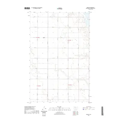
2020 Map of Grano SW
USGS Topo · Published 2020About this map
Lake Darling defines the northeastern edge of this prairie landscape, where the water's reach meets the rising topography of Renville County. The terrain is marked by the distinct drainage of Mackobee Coulee, a natural feature that cuts through the section lines of the Public Land Survey System. This survey reflects the enduring grid-based agricultural layout of North Dakota, where a network of section roads like Co Rd 26 and numbered streets from 75th St NW to 82nd St NW provide the primary infrastructure for the region. The map captures the intersection of natural water bodies and the precise human ordering of the plains, showing a high concentration of small wetlands and depressions typical of the prairie pothole region.
Find a feature on this map
15 named features on this map. Tap any name to fly to it.
Don’t see what you’re looking for? This feature index may not catch every label — zoom into the map to look around manually.
Map Details
Editions of this 2020 Grano SW Map
This is the sole edition of this map. No revisions or reprints were ever made.
Other maps of this area

1947 · Tolley
USGS Topo · 1:62,500

1948 · Tolley
USGS Topo · 1:24,000

1949 · Tolley SE
USGS Topo · 1:24,000

1949 · Hartland
USGS Topo · 1:24,000

1949 · Carpio NE
USGS Topo · 1:24,000

1949 · Carpio
USGS Topo · 1:24,000

1949 · Grano SW
USGS Topo · 1:24,000

1949 · Greene
USGS Topo · 1:24,000

1949 · Grano
USGS Topo · 1:24,000

1949 · Grano NE
USGS Topo · 1:24,000