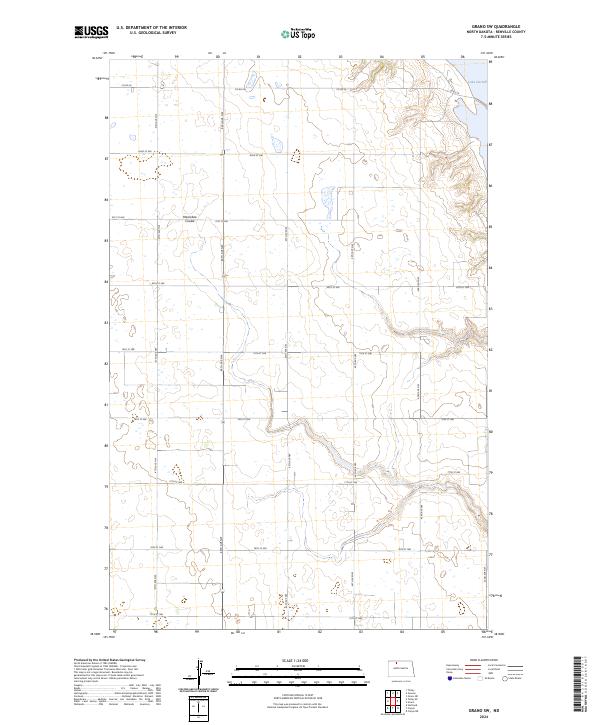
2024 Map of Grano SW
USGS Topo · Published 2024About this map
Upper Souris National Wildlife Refuge anchors the northeastern corner of this landscape, where the waters of Lake Darling meet the preserved prairies of Renville County. This modern survey illustrates a region defined by its conservation areas and precise section-line road network, including the Renville County Waterfowl Production Area. The terrain is marked by the winding path of Mackobee Coulee, which cuts through the central sections and influences the local drainage patterns. Significant for its depiction of the Public Land Survey System, the map clearly delineates township boundaries such as t159n r86w and t159n r85w, providing a detailed look at the rural organization of North Dakota's agricultural heartland. The layout of rural routes like Co RD 26 and numerous numbered section roads demonstrates the enduring grid-based infrastructure of the northern plains.
Find a feature on this map
17 named features on this map. Tap any name to fly to it.
Don’t see what you’re looking for? This feature index may not catch every label — zoom into the map to look around manually.
Map Details
Editions of this 2024 Grano SW Map
This is the sole edition of this map. No revisions or reprints were ever made.
Other maps of this area

1947 · Tolley
USGS Topo · 1:62,500

1948 · Tolley
USGS Topo · 1:24,000

1949 · Tolley SE
USGS Topo · 1:24,000

1949 · Hartland
USGS Topo · 1:24,000

1949 · Carpio NE
USGS Topo · 1:24,000

1949 · Carpio
USGS Topo · 1:24,000

1949 · Grano SW
USGS Topo · 1:24,000

1949 · Greene
USGS Topo · 1:24,000

1949 · Grano
USGS Topo · 1:24,000

1949 · Grano NE
USGS Topo · 1:24,000