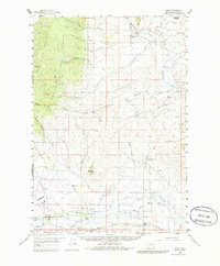
1959 Map of Grant
USGS Topo · Published 1985About this map
Horse Prairie dominates this 1950s landscape, where a series of ranching operations and irrigation projects define the local economy. The settlement of Grant serves as the focal point for a region marked by extensive water management, including the Mansfield-Prohosky Ditch and numerous smaller Ditch networks that divert water from Horse Prairie Creek and Peterson Creek to the surrounding valley floor. The map records the persistence of early homesteading and rural infrastructure, from the Old Knoll Homestead in the northeast to family-run properties like the Christensen Ranch and Hughes Ranch.
Find a feature on this map
63 named features on this map. Tap any name to fly to it.
Don’t see what you’re looking for? This feature index may not catch every label — zoom into the map to look around manually.
Map Details
Editions of this 1959 Grant Map
3 editions found

Other maps of this area

1893 · Dillon
USGS Topo · 1:250,000

1952 · Bannack
USGS Topo · 1:24,000

1952 · Eli Spring
USGS Topo · 1:24,000

1952 · Ermont
USGS Topo · 1:24,000

1955 · Dubois
USGS Topo · 1:250,000

1955 · Dillon
USGS Topo · 1:250,000

1957 · Dillon
USGS Topo · 1:250,000

1958 · Dubois
USGS Topo · 1:250,000

1958 · Dillon
USGS Topo · 1:250,000

1959 · Polaris
USGS Topo · 1:62,500