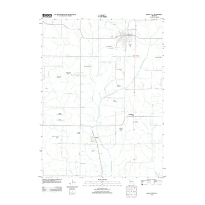
2012 Map of Grant City
USGS Topo · Published 2012About this map
The Middle Fork Grand River defines the central axis of this landscape, winding southward toward the small community of Worth. Further north, Grant City serves as the primary population center, positioned near the Grant City Dam and Grant City East Dam. The rural layout is characterized by a dense network of country roads, including Ross Ave and Co Rd-101, which connect isolated farmsteads and historic burial grounds. Genealogists can identify several local landmarks such as Smithton Cemetery, Fairview Cemetery, and Barnes Cemetery. The eastern portion of the map is marked by the uniquely named Prohibition City, while the western edge is defined by the drainage of Bear Creek. Numerous small impoundments like Gladstone Lake West Dam and Jay Lake Dam North dot the terrain, illustrating the region's reliance on managed water resources for agriculture and local use.
Find a feature on this map
80 named features on this map. Tap any name to fly to it.
Don’t see what you’re looking for? This feature index may not catch every label — zoom into the map to look around manually.
Map Details
Editions of this 2012 Grant City Map
This is the sole edition of this map. No revisions or reprints were ever made.
Other maps of this area

1940 · Blockton
USGS Topo · 1:62,500

1940 · Bedford
USGS Topo · 1:62,500

1940 · Parnell
USGS Topo · 1:62,500

1942 · Grant City
USGS Topo · 1:62,500

1943 · Bedford
USGS Topo · 1:62,500

1943 · Parnell
USGS Topo · 1:62,500

1943 · Grant City
USGS Topo · 1:62,500

1943 · Blockton
USGS Topo · 1:62,500

1955 · Nebraska City
USGS Topo · 1:250,000

1957 · Nebraska City
USGS Topo · 1:250,000