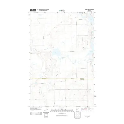
2013 Map of Grant Lake
USGS Topo · Published 2013About this map
The Mississippi River winds through the heart of this Northwoods landscape, shaping the boundaries and hydrology of the border between Beltrami Co and Hubbard Co. This 2013 survey illustrates a region defined by its numerous water bodies and glacial depressions, including Rice Lake and the chain formed by Grant Lake, Twin Lakes, and Bootleg Lake. The terrain is characterized by subtle elevation changes and significant wetlands, with drainage provided by watercourses like Grant Cr and Hennepin Cr. Modern road development is evident through a grid of secondary routes such as Becida Rd SW and Co Hwy 3, which provide access to residential pockets and local landmarks like the Bear Den. The map provides a contemporary look at the rural intersection of these two counties before further 21st-century development altered the shoreline properties.
Find a feature on this map
36 named features on this map. Tap any name to fly to it.
Don’t see what you’re looking for? This feature index may not catch every label — zoom into the map to look around manually.
Map Details
Editions of this 2013 Grant Lake Map
This is the sole edition of this map. No revisions or reprints were ever made.
Other maps of this area

1919 · Solway
USGS Topo · 1:62,500

1920 · Buena Vista
USGS Topo · 1:62,500

1943 · Solway
USGS Topo · 1:62,500

1954 · Bemidji
USGS Topo · 1:250,000

1957 · Bemidji
USGS Topo · 1:250,000

1958 · Bemidji
USGS Topo · 1:250,000

1968 · Frontenac Lake
USGS Topo · 1:24,000

1968 · Bemidji West
USGS Topo · 1:24,000

1972 · Alida
USGS Topo · 1:24,000

1972 · Peterson Lake
USGS Topo · 1:24,000