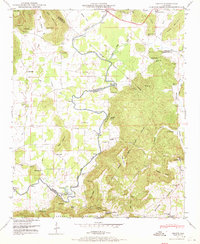
1947 Map of Grant
USGS Topo · Published 1970About this map
Paint Rock River meanders through the heart of this valley, serving as a vital natural corridor at the intersection of Madison, Marshall, and Jackson Counties. The landscape is defined by the high plateaus of Gunters Mountain and Keel Mountain, where small family-named settlements like Poplar Ridge and Old Center are situated above the river's winding course. This mid-century survey reveals a rural economy dependent on river crossings and mountain passes, evidenced by numerous historical fords such as Hellum Ford, Maple Ford, and Fishtrap Ford. Social life in this corner of Alabama centered on local institutions like Rockdale Ch and the DAR Sch at Grant. The intricate network of hollows and ridges, including Tick Ridge and Fishtrap Hollow, underscores the complex topography that isolated these communities before the expansion of modern highways, while the Southern Railway in the north provided the primary industrial link to the outside world.
Find a feature on this map
87 named features on this map. Tap any name to fly to it.
Don’t see what you’re looking for? This feature index may not catch every label — zoom into the map to look around manually.
Map Details
Editions of this 1947 Grant Map
4 editions found
Other maps of this area

1885 · Gadsden
USGS Topo · 1:125,000

1888 · Gadsden
USGS Topo · 1:125,000

1888 · Scottsboro
USGS Topo · 1:125,000

1892 · Scottsboro
USGS Topo · 1:125,000

1892 · Gadsden
USGS Topo · 1:125,000

1895 · Gadsden
USGS Topo · 1:125,000

1903 · Gadsden
USGS Topo · 1:125,000

1936 · Columbus City
USGS Topo · 1:24,000

1936 · New Hope
USGS Topo · 1:24,000

1936 · Guntersville Dam
USGS Topo · 1:24,000