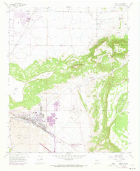
1957 Map of Grants
USGS Topo · Published 1973About this map
Grants sits at a critical intersection of transport and geology, positioned where the Atchison Topeka and Santa Fe rail line follows the path of the Rio San Jose. The landscape is dominated by the volcanic legacy of The Malpais and Lava beds to the south, while Grants Ridge and Black Mesa rise sharply to the north. These features illustrate the dramatic geological transition between the volcanic plains and the surrounding mesas.
Find a feature on this map
30 named features on this map. Tap any name to fly to it.
Don’t see what you’re looking for? This feature index may not catch every label — zoom into the map to look around manually.
Map Details
Editions of this 1957 Grants Map
Other maps of this area

1883 · Mt. Taylor
USGS Topo · 1:250,000

1886 · Mt. Taylor
USGS Topo · 1:250,000

1892 · Mt. Taylor
USGS Topo · 1:250,000

1899 · Mt. Taylor
USGS Topo · 1:250,000

1957 · San Rafael
USGS Topo · 1:24,000

1957 · Lobo Springs
USGS Topo · 1:24,000

1957 · Dos Lomas
USGS Topo · 1:24,000

1957 · Grants SE
USGS Topo · 1:24,000

1957 · Bluewater
USGS Topo · 1:24,000

1957 · Mc Cartys
USGS Topo · 1:24,000