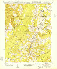
1949 Map of Grantsville
USGS Topo · Published 1949About this map
The Casselman River snakes through the high ridges of Garrett County on this late 1940s survey, revealing a landscape defined by sharp elevations and small mountain settlements. The community of Grantsville serves as a hub along the National Pike, while smaller hamlets like Jennings and Bevansville are connected by a network of winding roads and the B & O RR. Much of the western terrain is held within the Savage River State Forest, where features such as Keysers Ridge and Negro Mtn reach heights over 3,000 feet.
Find a feature on this map
67 named features on this map. Tap any name to fly to it.
Don’t see what you’re looking for? This feature index may not catch every label — zoom into the map to look around manually.
Map Details
Editions of this 1949 Grantsville Map
2 editions found
Other maps of this area

1899 · Grantsville
USGS Topo · 1:62,500

1900 · Accident
USGS Topo · 1:62,500

1904 · Grantsville
USGS Topo · 1:62,500

1921 · Meyersdale
USGS Topo · 1:62,500

1922 · Confluence
USGS Topo · 1:62,500

1931 · Confluence
USGS Topo · 1:62,500

1933 · Confluence
USGS Topo · 1:62,500

1939 · Meyersdale
USGS Topo · 1:62,500

1944 · Meyersdale
USGS Topo · 1:62,500

1946 · Grantsville
USGS Topo · 1:24,000