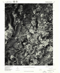
1977 Map of Grantsville
USGS Topo · Published 1979About this map
Grantsville and the surrounding Maryland-Pennsylvania borderlands are captured in this late 1970s orthophotoquad, showing a landscape defined by high-altitude agriculture and the winding path of the Casselman River. The imagery reveals the distinct field patterns and woodlots of the northern Garrett County region, where the terrain rises toward Meadow Mountain and the local landmark of Hi-Point. The settlement at Casselman sits at a transition point in the valley, while Springs marks the northern extent of the surveyed area across the state line. This photographic record provides a clear look at the road network and land use during a period of steady rural development, documenting the relationship between the small Appalachian communities and the drainage of the river as it cuts through the ridges.
Find a feature on this map
6 named features on this map. Tap any name to fly to it.
Don’t see what you’re looking for? This feature index may not catch every label — zoom into the map to look around manually.
Map Details
Editions of this 1977 Grantsville Map
This is the sole edition of this map. No revisions or reprints were ever made.
Other maps of this area

1899 · Grantsville
USGS Topo · 1:62,500

1900 · Accident
USGS Topo · 1:62,500

1904 · Grantsville
USGS Topo · 1:62,500

1921 · Meyersdale
USGS Topo · 1:62,500

1922 · Confluence
USGS Topo · 1:62,500

1931 · Confluence
USGS Topo · 1:62,500

1933 · Confluence
USGS Topo · 1:62,500

1939 · Meyersdale
USGS Topo · 1:62,500

1944 · Meyersdale
USGS Topo · 1:62,500

1946 · Grantsville
USGS Topo · 1:24,000