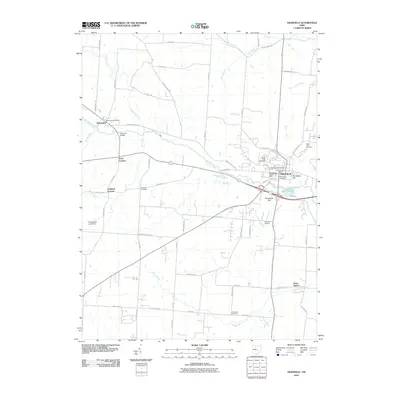
2010 Map of Granville
USGS Topo · Published 2010About this map
Denison University and the community of Granville serve as the focal point of this Licking County landscape, where the academic grounds overlook a terrain shaped by Raccoon Creek. The village character is defined by its historic cemeteries, including Old Colony Cemetery and College Hill Cemetery, alongside prominent local elevations like Sugarloaf Hill and Parnassus Hill. To the west, the village of Alexandria and small crossroads like Scott Corners and Goddard Corners indicate a long-established rural settlement pattern.
Find a feature on this map
72 named features on this map. Tap any name to fly to it.
Don’t see what you’re looking for? This feature index may not catch every label — zoom into the map to look around manually.
Map Details
Editions of this 2010 Granville Map
This is the sole edition of this map. No revisions or reprints were ever made.
Other maps of this area

1907 · Thurston
USGS Topo · 1:62,500

1908 · Granville
USGS Topo · 1:62,500

1909 · Newark
USGS Topo · 1:62,500

1909 · Thornville
USGS Topo · 1:62,500

1909 · Thurston
USGS Topo · 1:62,500

1910 · Granville
USGS Topo · 1:62,500

1947 · Columbus
USGS Topo · 1:250,000

1950 · Marion
USGS Topo · 1:250,000
1958 · Pataskala
USGS Topo · 1:24,000

1961 · Columbus
USGS Topo · 1:250,000