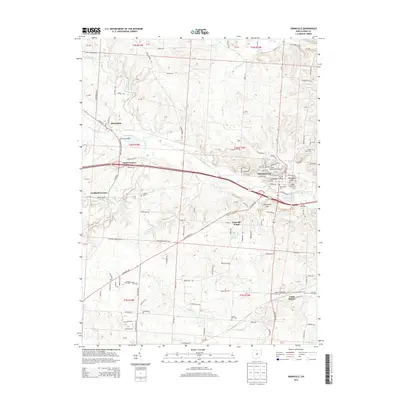
2013 Map of Granville
USGS Topo · Published 2013About this map
Granville stands as the central hub of this Licking County landscape, defined by its historic academic and topographical landmarks. The campus of Stadium Denison Univ overlooks the town from the heights, while the surrounding terrain is marked by distinctive elevations like Sugarloaf Hill and Parnassus Hill. To the west and south, smaller settlements and junctions including Alexandria, Scott Corners, and Union Station reflect the rural development patterns of the early 21st century.
Find a feature on this map
121 named features on this map. Tap any name to fly to it.
Don’t see what you’re looking for? This feature index may not catch every label — zoom into the map to look around manually.
Map Details
Editions of this 2013 Granville Map
This is the sole edition of this map. No revisions or reprints were ever made.
Other maps of this area

1907 · Thurston
USGS Topo · 1:62,500

1908 · Granville
USGS Topo · 1:62,500

1909 · Newark
USGS Topo · 1:62,500

1909 · Thornville
USGS Topo · 1:62,500

1909 · Thurston
USGS Topo · 1:62,500

1910 · Granville
USGS Topo · 1:62,500

1947 · Columbus
USGS Topo · 1:250,000

1950 · Marion
USGS Topo · 1:250,000
1958 · Pataskala
USGS Topo · 1:24,000

1961 · Columbus
USGS Topo · 1:250,000