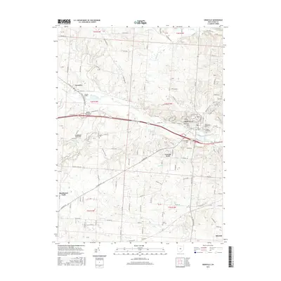
2016 Map of Granville
USGS Topo · Published 2016About this map
Granville serves as the focal point of this Licking County landscape, home to the sprawling campus of Denison Univ and a series of historically significant burial grounds including Old Colony Cem and Maple Grove Cem. The terrain is defined by the winding course of Raccoon Creek, which is fed by numerous tributaries such as Lobdell Cr and Salt Run. Notable elevations like Sugarloaf Hill and Flowerpot Hill rise above the valley, while the village of Alexandria sits to the west near Mclains Bridge. This 2016 survey provides a modern view of the established residential and educational infrastructure, contrasting the developed center of Granville with peripheral settlements like Goddard Corners and Beechwood Trails. Genealogists may find interest in the documented locations of rural cemeteries such as Gaffield Cem and the evocatively named Devils Den Cem.
Find a feature on this map
128 named features on this map. Tap any name to fly to it.
Don’t see what you’re looking for? This feature index may not catch every label — zoom into the map to look around manually.
Map Details
Editions of this 2016 Granville Map
This is the sole edition of this map. No revisions or reprints were ever made.
Other maps of this area

1907 · Thurston
USGS Topo · 1:62,500

1908 · Granville
USGS Topo · 1:62,500

1909 · Newark
USGS Topo · 1:62,500

1909 · Thornville
USGS Topo · 1:62,500

1909 · Thurston
USGS Topo · 1:62,500

1910 · Granville
USGS Topo · 1:62,500

1947 · Columbus
USGS Topo · 1:250,000

1950 · Marion
USGS Topo · 1:250,000
1958 · Pataskala
USGS Topo · 1:24,000

1961 · Columbus
USGS Topo · 1:250,000