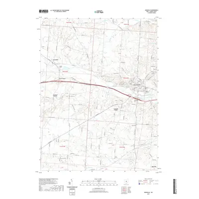
2019 Map of Granville
USGS Topo · Published 2019About this map
Granville and the campus of Denison University anchor this Licking County landscape, where the terrain transitions from the valley of Raccoon Creek to prominent local heights like College Hill and Sugarloaf Hill. The town layout reflects its established character, featuring the Old Colony Cem and Maple Grove Cem near the central district. To the west, the village of Alexandria is connected by W Main St, crossing the water at McLains Bridge. The map records a dense network of township roads and rural settlements such as Scott Corners and Goddard Corners, revealing the persistent agricultural and residential patterns of the region. Notable local landmarks include Lake Hudson to the east and the secluded Devils Den Cem to the south. This survey provides a comprehensive look at the area's development, from the historic Welsh influence seen at Welsh Hills Cem to the modern boundaries of Heath.
Find a feature on this map
132 named features on this map. Tap any name to fly to it.
Don’t see what you’re looking for? This feature index may not catch every label — zoom into the map to look around manually.
Map Details
Editions of this 2019 Granville Map
This is the sole edition of this map. No revisions or reprints were ever made.
Other maps of this area

1907 · Thurston
USGS Topo · 1:62,500

1908 · Granville
USGS Topo · 1:62,500

1909 · Newark
USGS Topo · 1:62,500

1909 · Thornville
USGS Topo · 1:62,500

1909 · Thurston
USGS Topo · 1:62,500

1910 · Granville
USGS Topo · 1:62,500

1947 · Columbus
USGS Topo · 1:250,000

1950 · Marion
USGS Topo · 1:250,000
1958 · Pataskala
USGS Topo · 1:24,000

1961 · Columbus
USGS Topo · 1:250,000