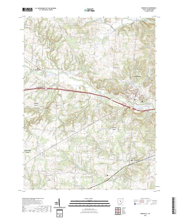
2023 Map of Granville
USGS Topo · Published 2023About this map
Denison University occupies a prominent ridge overlooking the village of Granville, where the cultural and educational history of Licking County is preserved in the surrounding landscape. The area is dense with early burial grounds, including the historic Old Colony Cem and the Welsh Hills Cem, reflecting the early 19th-century settlement patterns of the region. The terrain is defined by dramatic elevations like Sugarloaf Hill and Parnassus Hill, which stand above the winding path of Raccoon Creek.
Find a feature on this map
125 named features on this map. Tap any name to fly to it.
Don’t see what you’re looking for? This feature index may not catch every label — zoom into the map to look around manually.
Map Details
Editions of this 2023 Granville Map
This is the sole edition of this map. No revisions or reprints were ever made.
Other maps of this area
1907 · Thurston
USGS Topo · 1:62,500

1908 · Granville
USGS Topo · 1:62,500

1909 · Newark
USGS Topo · 1:62,500
1909 · Thornville
USGS Topo · 1:62,500
1909 · Thurston
USGS Topo · 1:62,500

1910 · Granville
USGS Topo · 1:62,500

1947 · Columbus
USGS Topo · 1:250,000

1950 · Marion
USGS Topo · 1:250,000
1958 · Pataskala
USGS Topo · 1:24,000
1961 · Columbus
USGS Topo · 1:250,000