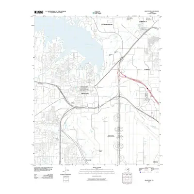
2010 Map of Grapevine
USGS Topo · Published 2010About this map
Grapevine Lake dominates the northern landscape of this North Texas quadrangle, where the Grapevine Dam manages the waters of Denton Creek. The city of Grapevine serves as a central hub, featuring both the Grapevine Original Town Residential Historic District and the Grapevine Commercial Historic District, indicating a preserved core amidst modern expansion. Significant aviation infrastructure is present with the northern portion of the Dallas/Fort Worth International Airport occupying the southern half of the map. Smaller watercourses like Cottonwood Branch and Big Bear Creek weave through suburban developments in Euless, Southlake, and Coppell. Local history is anchored by the Minters Chapel and Parker Memorial Cemetery, providing touchstones for genealogical research in an area defined by its rapid transition from rural roots to a major metropolitan transport corridor.
Find a feature on this map
78 named features on this map. Tap any name to fly to it.
Don’t see what you’re looking for? This feature index may not catch every label — zoom into the map to look around manually.
Map Details
Editions of this 2010 Grapevine Map
This is the sole edition of this map. No revisions or reprints were ever made.
Other maps of this area

1891 · Dallas
USGS Topo · 1:125,000

1893 · Dallas
USGS Topo · 1:125,000

1894 · Fort Worth
USGS Topo · 1:125,000

1925 · Mc Kinney 3-c
USGS Topo · 1:48,000

1925 · Dallas 2-b
USGS Topo · 1:48,000

1929 · Frisco
USGS Topo · 1:62,500

1931 · Carrollton
USGS Topo · 1:62,500

1931 · Grapevine
USGS Topo · 1:62,500

1954 · Dallas
USGS Topo · 1:250,000

1954 · Sherman
USGS Topo · 1:250,000