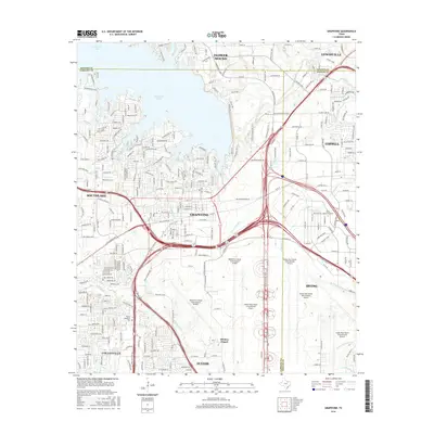
2016 Map of Grapevine
USGS Topo · Published 2016About this map
Grapevine Lake and the massive infrastructure of the Dallas/Fort Worth International Airport dominate this landscape during the mid-2010s. The map illustrates a dense network of modern transportation corridors, including the International Pkwy and the W John Carpenter Fwy, which facilitate travel between the surrounding suburban cities. Despite this heavy development, historical markers such as Minters Chapel and the Parker Memorial Cem remain as physical connections to the area's earlier rural identity.
Find a feature on this map
31 named features on this map. Tap any name to fly to it.
Don’t see what you’re looking for? This feature index may not catch every label — zoom into the map to look around manually.
Map Details
Editions of this 2016 Grapevine Map
This is the sole edition of this map. No revisions or reprints were ever made.
Other maps of this area

1891 · Dallas
USGS Topo · 1:125,000

1893 · Dallas
USGS Topo · 1:125,000

1894 · Fort Worth
USGS Topo · 1:125,000

1925 · Mc Kinney 3-c
USGS Topo · 1:48,000

1925 · Dallas 2-b
USGS Topo · 1:48,000

1929 · Frisco
USGS Topo · 1:62,500

1931 · Carrollton
USGS Topo · 1:62,500

1931 · Grapevine
USGS Topo · 1:62,500

1954 · Dallas
USGS Topo · 1:250,000

1954 · Sherman
USGS Topo · 1:250,000