2022 Map of Grapevine
USGS Topo · Published 2022About this map
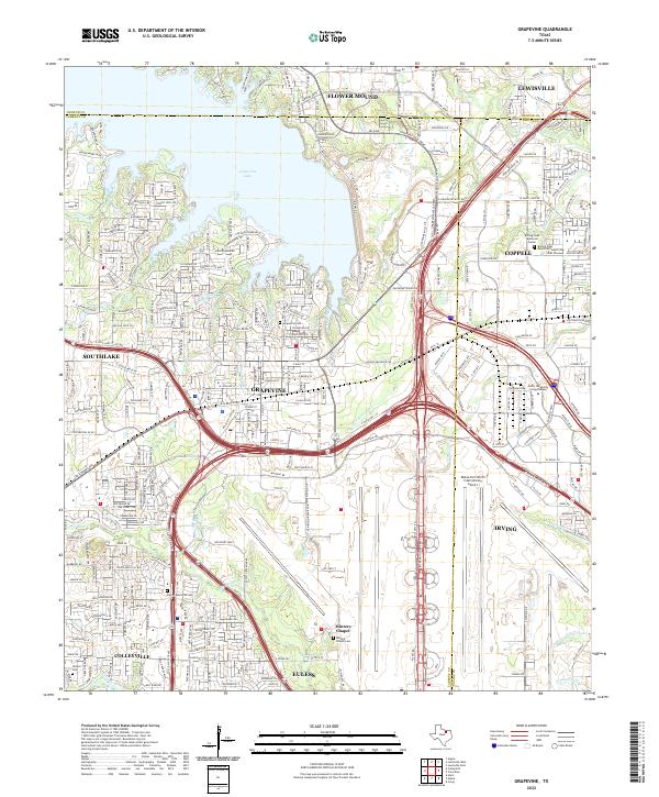
Grapevine and its surrounding suburbs appear at a moment of dense suburban and logistical development in this 2022 survey. The landscape is dominated by the sprawling infrastructure of the Dallas-Fort Worth International Airport and a complex web of highways, including the International Pkwy and State Hwy 121. Despite this modernization, several local history anchors remain visible, such as Minters Chapel and the nearby Minters Chapel Cem. North of the urban center, Grapevine Lake provides a significant recreational and hydrological boundary, with Oak Grove Park lining its shores. The map captures the meeting of three counties—Denton, Tarrant, and Dallas—illustrating how transit corridors like the W John Carpenter Fwy have knit these jurisdictions together into a continuous metropolitan fabric.
Find a feature on this map
143 named features on this map. Tap any name to fly to it.
Don’t see what you’re looking for? This feature index may not catch every label — zoom into the map to look around manually.
Map Details
Editions of this 2022 Grapevine Map
This is the sole edition of this map. No revisions or reprints were ever made.
Historical Maps of Euless Through Time
4 maps found