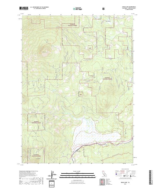
2021 Map of Grass Lake
USGS Topo · Published 2021About this map
Grass Lake dominates the southern portion of this Siskiyou County landscape, situated within the extensive boundaries of the Klamath National Forest. The area is defined by significant topographical elevations, including Miller Mtn and Herd Peak to the southwest, and the prominent peak of Goosenest in the northwest. This high-altitude terrain is marked by a network of drainage systems and springs, such as Bearwallow Spring and Dairy Cr, which feed into the central basin.
Find a feature on this map
26 named features on this map. Tap any name to fly to it.
Don’t see what you’re looking for? This feature index may not catch every label — zoom into the map to look around manually.
Map Details
Editions of this 2021 Grass Lake Map
This is the sole edition of this map. No revisions or reprints were ever made.
Other maps of this area

1886 · Shasta
USGS Topo · 1:250,000

1894 · Shasta
USGS Topo · 1:250,000

1922 · Shasta Valley Sheet No 10 E
USGS Topo · 1:24,000

1934 · Macdoel
USGS Topo · 1:96,000

1941 · Macdoel
USGS Topo · 1:125,000

1948 · Weed
USGS Topo · 1:250,000

1950 · Weed
USGS Topo · 1:250,000

1954 · The Whaleback
USGS Topo · 1:62,500

1954 · Macdoel
USGS Topo · 1:62,500
1954 · Copco
USGS Topo · 1:62,500