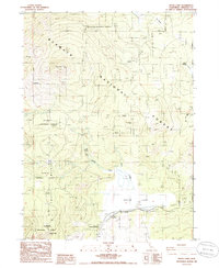
1986 Map of Grass Lake
USGS Topo · Published 1986About this map
Grass Lake Forest Service Station stands as a focal point in this 1980s landscape of Siskiyou County, where management of the surrounding Klamath National Forest is central to the area's identity. The map illustrates a high-elevation environment dominated by drainage systems and seasonal wetlands, most notably at Bull Meadow and along the headwaters of First Cr. These features suggest a terrain defined more by forestry operations and seasonal natural cycles than by permanent residential development. The presence of the service station indicates a period of active federal oversight and conservation, providing a specific point of interest for those researching the institutional history of land management and forestry in Northern California during the late twentieth century.
Find a feature on this map
3 named features on this map. Tap any name to fly to it.
Don’t see what you’re looking for? This feature index may not catch every label — zoom into the map to look around manually.
Map Details
Editions of this 1986 Grass Lake Map
This is the sole edition of this map. No revisions or reprints were ever made.
Other maps of this area

1886 · Shasta
USGS Topo · 1:250,000

1894 · Shasta
USGS Topo · 1:250,000

1922 · Shasta Valley Sheet No 10 E
USGS Topo · 1:24,000

1934 · Macdoel
USGS Topo · 1:96,000

1941 · Macdoel
USGS Topo · 1:125,000

1948 · Weed
USGS Topo · 1:250,000

1950 · Weed
USGS Topo · 1:250,000

1954 · The Whaleback
USGS Topo · 1:62,500

1954 · Macdoel
USGS Topo · 1:62,500
1954 · Copco
USGS Topo · 1:62,500