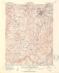
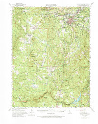
1949 Map of Grass Valley
USGS Topo · Published 1953About this map
Grass Valley serves as the industrial and social heart of this 1949 survey, surrounded by a dense network of hard-rock gold mines that shaped the Sierra Nevada foothills. The map documents legendary operations like the Empire Mine, North Star Mine, and Idaho Maryland Mine, alongside smaller works such as the Scotia Mine and Ophir Hill Mine. This concentration of mining activity transitions westward into a complex system of ditches and ravines, such as Squirrel Creek and Deer Creek, which historically supplied the hydraulic and hard-rock operations of the region.
Find a feature on this map
114 named features on this map. Tap any name to fly to it.
Don’t see what you’re looking for? This feature index may not catch every label — zoom into the map to look around manually.
Map Details
Editions of this 1949 Grass Valley Map
5 editions found
Other maps of this area

1888 · Smartsville
USGS Topo · 1:125,000

1891 · Sacramento
USGS Topo · 1:125,000

1891 · Colfax
USGS Topo · 1:125,000

1891 · Smartsville
USGS Topo · 1:125,000

1891 · Placerville
USGS Topo · 1:125,000

1892 · Sacramento
USGS Topo · 1:125,000

1892 · Placerville
USGS Topo · 1:125,000

1892 · Smartsville
USGS Topo · 1:125,000

1892 · Colfax
USGS Topo · 1:125,000

1893 · Placerville
USGS Topo · 1:125,000