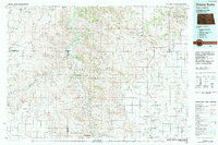
1983 Map of Grassy Butte
USGS Topo · Published 1983About this map
The Little Missouri River carves a complex course through the Badlands of western North Dakota, anchoring a landscape dominated by the Little Missouri National Grassland. This 1983 compilation reveals a region defined by federal land management and cattle ranching, featuring the Theodore Roosevelt National Park (Elkhorn Ranch Site) and the South Unit of the park. Small communities like Grassy Butte, Fairfield, and Gorham dot the uplands, serving as isolated hubs in a vast topography of buttes and coulees.
Find a feature on this map
53 named features on this map. Tap any name to fly to it.
Don’t see what you’re looking for? This feature index may not catch every label — zoom into the map to look around manually.
Map Details
Editions of this 1983 Grassy Butte Map
This is the sole edition of this map. No revisions or reprints were ever made.
Other maps of this area

1909 · Glendive
USGS Topo · 1:250,000

1953 · Miles City
USGS Topo · 1:250,000

1953 · Dickinson
USGS Topo · 1:250,000

1953 · Watford City
USGS Topo · 1:250,000

1954 · Glendive
USGS Topo · 1:250,000

1957 · Dickinson
USGS Topo · 1:250,000

1957 · Miles City
USGS Topo · 1:250,000

1957 · Glendive
USGS Topo · 1:250,000

1957 · Watford City
USGS Topo · 1:250,000

1958 · Miles City
USGS Topo · 1:250,000