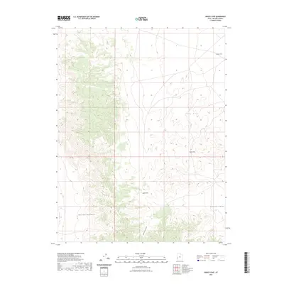
2023 Map of Grassy Cove
USGS Topo · Published 2023About this map
The Wah Wah Mountains dominate the western portion of this terrain, transitioning into the broad expanse of Pine Valley to the southwest. This area of Millard County is defined by its dramatic elevation changes and natural corridors, specifically the narrow routes of Upper Pass and Middle Pass that cut through the north-south trending ridges. These passes historically served as vital points of transit between the arid basins, connecting the higher slopes of the Gray Hills to the surrounding coves.
Find a feature on this map
8 named features on this map. Tap any name to fly to it.
Don’t see what you’re looking for? This feature index may not catch every label — zoom into the map to look around manually.
Map Details
Editions of this 2023 Grassy Cove Map
This is the sole edition of this map. No revisions or reprints were ever made.
Other maps of this area

1953 · Richfield
USGS Topo · 1:250,000

1958 · Richfield
USGS Topo · 1:250,000

1960 · Frisco Peak
USGS Topo · 1:62,500

1960 · Wah Wah Summit
USGS Topo · 1:62,500

1960 · Crystal Peak
USGS Topo · 1:62,500

1960 · The Barn
USGS Topo · 1:62,500

1980 · Wah Wah Mts. North
USGS Topo · 1:100,000
1989 · Wah Wah Cove
USGS Topo · 1:24,000
1989 · Wah Wah Summit
USGS Topo · 1:24,000
1989 · Pine Valley Hardpan South
USGS Topo · 1:24,000