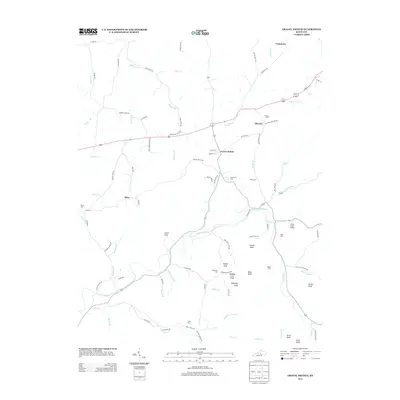
2013 Map of Gravel Switch
USGS Topo · Published 2013About this map
Gravel Switch serves as a central point in this rural landscape, where local roads converge near the N Rolling Fork and Beech Fork rivers. The settlement pattern is defined by small clusters at Aliceton, Craintown, and Riley, connected by a network of winding roads like Craintown Rd and Aliceton Rd. This 2013 survey illustrates a region where family and community history are preserved in numerous small burial grounds, including the Rollertown Cem, Elder Cem, and Rogers Cem. The topography is marked by distinctive elevations and landmarks such as Lovers Leap, Buffalo Lick Knob, and Connie Knob, which overlook the fertile bottomlands and creeks. This detailed record of the Marion County countryside captures the enduring agricultural character of the area, punctuated by crossings like the Little South Bridge and the drainages of Goose Cr and Lick Run.
Find a feature on this map
92 named features on this map. Tap any name to fly to it.
Don’t see what you’re looking for? This feature index may not catch every label — zoom into the map to look around manually.
Map Details
Editions of this 2013 Gravel Switch Map
This is the sole edition of this map. No revisions or reprints were ever made.
Other maps of this area

1905 · Harrodsburg
USGS Topo · 1:125,000

1952 · Perryville
USGS Topo · 1:24,000

1952 · Ellisburg
USGS Topo · 1:24,000

1952 · Bradfordsville
USGS Topo · 1:24,000

1952 · Parksville
USGS Topo · 1:24,000

1953 · Mackville
USGS Topo · 1:24,000

1953 · Bradfordsville NE
USGS Topo · 1:24,000

1953 · Gravel Switch
USGS Topo · 1:24,000

1953 · Lebanon East
USGS Topo · 1:24,000

1953 · Springfield
USGS Topo · 1:24,000