
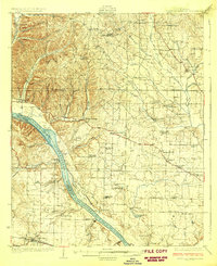
1926 Map of Gravelly Springs
USGS Topo · Published 1926About this map
The Tennessee River flows through the heart of this 1920s landscape, serving as the border between Lauderdale and Colbert counties. The river's character is defined by the engineered Colbert Shoals Canal and historical river crossings like Georgetown Landing and Newport Landing. To the north, the terrain is dotted with small agricultural settlements and a high density of rural institutions, such as the Lyle Academy, Beulah School, and numerous houses of worship including Salem Church and Shiloh Church.
Find a feature on this map
78 named features on this map. Tap any name to fly to it.
Don’t see what you’re looking for? This feature index may not catch every label — zoom into the map to look around manually.
Map Details
Editions of this 1926 Gravelly Springs Map
2 editions found
Other maps of this area

1905 · Waynesboro
USGS Topo · 1:125,000

1911 · Iuka
USGS Topo · 1:48,000

1914 · Iuka
USGS Topo · 1:62,500

1914 · Muscle Shoals
USGS Topo · 1:48,000

1916 · Muscle Shoals
USGS Topo · 1:62,500

1924 · Tuscumbia
USGS Topo · 1:48,000

1924 · Gravelly Springs
USGS Topo · 1:48,000

1925 · Barton
USGS Topo · 1:62,500

1926 · Tuscumbia
USGS Topo · 1:62,500

1926 · Barton
USGS Topo · 1:48,000