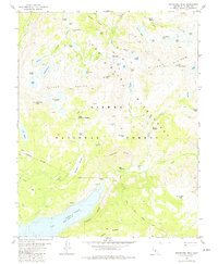
1982 Map of Graveyard Peak
USGS Topo · Published 1982About this map
The high Sierra Nevada landscape of Sierra National Forest is defined here by the steep granite of the Silver Divide and the remote reaches of the John Muir Wilderness. In the early 1980s, this area served as a critical corridor for backpackers and mountaineers, centered on the Pacific Crest National Scenic Trail as it winds past Silver Pass. Evidence of historical prospecting remains at the Pick and Shovel Mine near Cascade Valley, contrasting with the modern infrastructure of Lake Thomas A Edison and its designated spillway. The map captures a high-elevation world of glacial basins containing Graveyard Lakes and Lake of the Lone Indian, alongside vast meadows like Quail Meadows and Upper Graveyard Meadow that historically supported seasonal travel through the Vermilion Cliffs.
Find a feature on this map
60 named features on this map. Tap any name to fly to it.
Don’t see what you’re looking for? This feature index may not catch every label — zoom into the map to look around manually.
Map Details
Editions of this 1982 Graveyard Peak Map
3 editions found
Other maps of this area

1901 · Mt. Lyell
USGS Topo · 1:125,000

1904 · Kaiser
USGS Topo · 1:125,000

1912 · Mt. Goddard
USGS Topo · 1:125,000

1914 · Mt. Morrison
USGS Topo · 1:125,000

1947 · Mariposa
USGS Topo · 1:250,000

1948 · Mariposa
USGS Topo · 1:250,000

1953 · Mt. Morrison
USGS Topo · 1:62,500

1953 · Mt Abbot
USGS Topo · 1:62,500

1953 · Devils Postpile
USGS Topo · 1:62,500

1953 · Kaiser Peak
USGS Topo · 1:62,500