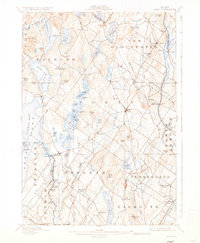
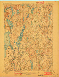
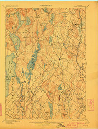
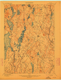
1898 Map of Gray
USGS Topo · Published 1936About this map
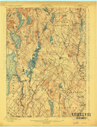
Sebago Lake and its expansive Jordan Bay dominate the western portion of this late 19th-century survey, illustrating a landscape defined by glacial lakes and a developing rail economy. The transport network of central Cumberland County is clearly delineated, showing the Grand Trunk Railroad cutting through the northeast corner while the Maine Central R. R. serves the southern and eastern corridors. Small regional centers such as New Gloucester, Gray, and Windham Center appear as established hubs connected by a web of early roads.
Find a feature on this map
113 named features on this map. Tap any name to fly to it.
Don’t see what you’re looking for? This feature index may not catch every label — zoom into the map to look around manually.
Map Details
Editions of this 1898 Gray Map
7 editions found


Other maps of this area

1891 · Portland
USGS Topo · 1:62,500

1891 · Buxton
USGS Topo · 1:62,500

1892 · Freeport
USGS Topo · 1:62,500

1892 · Buxton
USGS Topo · 1:62,500

1893 · Portland
USGS Topo · 1:62,500

1893 · Casco Bay
USGS Topo · 1:62,500

1893 · Buxton
USGS Topo · 1:62,500

1894 · Gray
USGS Topo · 1:62,500

1896 · Norway
USGS Topo · 1:62,500

1896 · Sebago
USGS Topo · 1:62,500