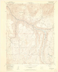
1953 Map of Gray Head
USGS Topo · Published 1961About this map
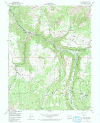
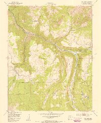
Mining and industrial operations along the San Miguel River characterize this 1953 topographic study of the San Miguel region. Small settlements and specialized work sites like Vanadium, Saw Pit, and Ilium are clustered along the river corridor and the Old Railroad Grade, reflecting the importance of transportation and mineral extraction in this corner of the Uncompahgre National Forest. The presence of the Belle Champion Mine near the river and a (Covered Flume) near Vance Junction points to the complex infrastructure required for high-altitude resource processing.
Find a feature on this map
37 named features on this map. Tap any name to fly to it.
Don’t see what you’re looking for? This feature index may not catch every label — zoom into the map to look around manually.
Map Details
Editions of this 1953 Gray Head Map
6 editions found
Other maps of this area

1897 · Telluride
USGS Topo · 1:62,500

1904 · Telluride
USGS Topo · 1:62,500

1909 · Montrose
USGS Topo · 1:125,000

1911 · Montrose
USGS Topo · 1:125,000

1945 · Durango
USGS Topo · 1:250,000

1953 · Mount Wilson
USGS Topo · 1:24,000

1953 · Dolores Peak
USGS Topo · 1:24,000

1953 · Placerville
USGS Topo · 1:24,000
1953 · Gray Head
USGS Topo · 1:24,000

1953 · Little Cone
USGS Topo · 1:24,000