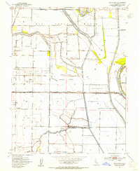
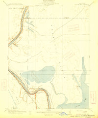
1953 Map of Grays Bend
USGS Topo · Published 1954About this map
The water-managed landscape of the Rio Jesus Maria land grant defines this mid-century survey of the Central Valley. Heavy engineering is evident throughout the terrain, dominated by the Yolo Bypass and the Knights Landing Ridge Cut, which channel the Sacramento River and Cache Creek to prevent seasonal flooding. This infrastructure supports a specialized agricultural economy, visible in the industrial footprints of the Beet Pulp Silo and several Labor Camp locations.
Find a feature on this map
35 named features on this map. Tap any name to fly to it.
Don’t see what you’re looking for? This feature index may not catch every label — zoom into the map to look around manually.
Map Details
Editions of this 1953 Grays Bend Map
4 editions found
Other maps of this area

1907 · Dunnigan
USGS Topo · 1:62,500

1907 · Woodland
USGS Topo · 1:62,500

1907 · Davisville
USGS Topo · 1:62,500

1910 · Knights Landing
USGS Topo · 1:31,680

1910 · Vernon
USGS Topo · 1:31,680

1915 · Yolo
USGS Topo · 1:31,680

1915 · Swingle
USGS Topo · 1:31,680

1915 · Ronda
USGS Topo · 1:31,680
1915 · Elkhorn Weir
USGS Topo · 1:31,680

1915 · Merritt
USGS Topo · 1:31,680