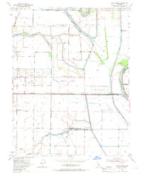
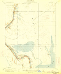
1953 Map of Grays Bend
USGS Topo · Published 1970About this map
Agricultural and hydrological engineering dominates the landscape of the Rio Jesus Maria Grant in the early 1950s. The map illustrates a complex system of water management designed to control the Sacramento River and its tributaries, notably through the Yolo Bypass and the Cache Creek Settling Basin. Infrastructure like the Knights Landing Ridge Cut and the Tule Canal demonstrate the era's focus on reclamation and flood control for the surrounding fertile fields.
Find a feature on this map
34 named features on this map. Tap any name to fly to it.
Don’t see what you’re looking for? This feature index may not catch every label — zoom into the map to look around manually.
Map Details
Editions of this 1953 Grays Bend Map
4 editions found
Other maps of this area

1907 · Dunnigan
USGS Topo · 1:62,500

1907 · Woodland
USGS Topo · 1:62,500

1907 · Davisville
USGS Topo · 1:62,500

1910 · Knights Landing
USGS Topo · 1:31,680

1910 · Vernon
USGS Topo · 1:31,680

1915 · Yolo
USGS Topo · 1:31,680

1915 · Swingle
USGS Topo · 1:31,680

1915 · Ronda
USGS Topo · 1:31,680
1915 · Elkhorn Weir
USGS Topo · 1:31,680

1915 · Merritt
USGS Topo · 1:31,680