1970 Map of Grayton Beach
USGS Topo · Published 1972About this map
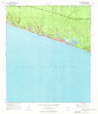
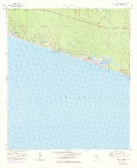
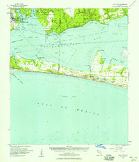
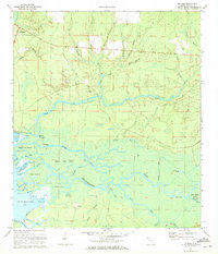
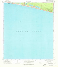
Coastal dune lakes and emerging resort communities characterize this Gulf of Mexico shoreline just before the region's massive late-century development. Grayton Beach State Park dominates the central coast, protecting the significant Western Lake and its surrounding sand dunes. This survey captures the modest early footprints of coastal settlements like Santa Rosa Beach, Blue Mountain Beach, and Seagrove Beach, which are connected by a network of unimproved roads and several jeep trails. North of the coastal ridge, the landscape transitions to a complex system of bayous, including Bowman and McQuage Bayou, where the land begins to rise toward Blue Mtn. Genealogists may find interest in a small cemetery located inland from Dune Allen Beach, while the presence of a Boat Ramp and Campgrounds near the state park indicates the area's growing identity as a recreational destination in the early 1970s.
Find a feature on this map
45 named features on this map. Tap any name to fly to it.
Don’t see what you’re looking for? This feature index may not catch every label — zoom into the map to look around manually.
Map Details
Editions of this 1970 Grayton Beach Map
3 editions found

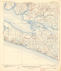
Other maps of this area

1935 · Villa Tasso
USGS Topo · 1:48,000

1936 · Point Washington
USGS Topo · 1:48,000

1938 · Villa Tasso
USGS Topo · 1:62,500
1939 · Point Washington
USGS Topo · 1:62,500
1956 · Villa Tasso
USGS Topo · 1:62,500

1957 · Pensacola
USGS Topo · 1:250,000

1959 · Pensacola
USGS Topo · 1:250,000

1960 · Pensacola
USGS Topo · 1:250,000
1970 · Bunker
USGS Topo · 1:24,000
1970 · Miramar Beach
USGS Topo · 1:24,000