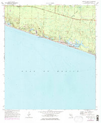
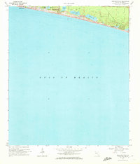
1970 Map of Grayton Beach
USGS Topo · Published 1977About this map
Santa Rosa Beach and its neighboring coastal hamlets line the Emerald Coast in this 1970s record, capturing the area's development before its modern population boom. The landscape is defined by a series of rare coastal dune lakes, including Oyster Lake, Draper Lake, Big Redfish Lake, Little Redfish Lake, Alligator Lake, and the expansive Western Lake, many of which are linked to the Gulf of Mexico by narrow outlets. These freshwater bodies sit just behind high Sand Dunes, creating a unique hydrological environment.
Find a feature on this map
29 named features on this map. Tap any name to fly to it.
Don’t see what you’re looking for? This feature index may not catch every label — zoom into the map to look around manually.
Map Details
Editions of this 1970 Grayton Beach Map
3 editions found
Other maps of this area

1935 · Villa Tasso
USGS Topo · 1:48,000

1936 · Point Washington
USGS Topo · 1:48,000

1938 · Villa Tasso
USGS Topo · 1:62,500

1939 · Point Washington
USGS Topo · 1:62,500

1956 · Villa Tasso
USGS Topo · 1:62,500

1957 · Pensacola
USGS Topo · 1:250,000

1959 · Pensacola
USGS Topo · 1:250,000

1960 · Pensacola
USGS Topo · 1:250,000
1970 · Bunker
USGS Topo · 1:24,000
1970 · Miramar Beach
USGS Topo · 1:24,000