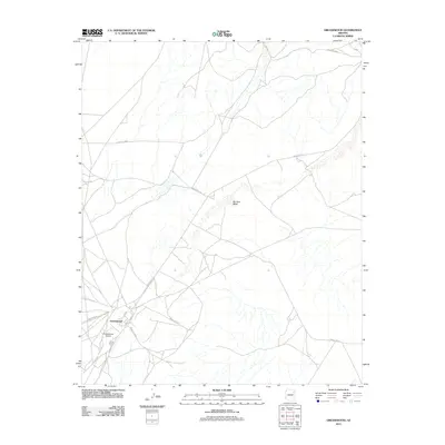
2011 Map of Greasewood
USGS Topo · Published 2011About this map
Greasewood serves as the central hub of this High Desert landscape, where a network of Bureau of Indian Affairs routes converges. The settlement is defined by its position at the intersection of Indian Rte-15 and Indian Rte-9003, a junction that anchors the local transportation system. The surrounding terrain is primarily shaped by the ephemeral drainage of Big Dam Wash, which trends through the center of the quadrangle. This 2011 survey by the U.S. Geological Survey details the contemporary road infrastructure of the Fort Defiance Agency area, including named thoroughfares like Aztec and Indian Rte-152. The map illustrates a pattern of dispersed activity and wide-reaching routes characteristic of the Colorado Plateau, where these roads provide essential links between remote points of interest and the primary residential core.
Find a feature on this map
10 named features on this map. Tap any name to fly to it.
Don’t see what you’re looking for? This feature index may not catch every label — zoom into the map to look around manually.
Map Details
Editions of this 2011 Greasewood Map
This is the sole edition of this map. No revisions or reprints were ever made.
Other maps of this area

1886 · Fort Defiance
USGS Topo · 1:250,000

1892 · Fort Defiance
USGS Topo · 1:250,000

1954 · Gallup
USGS Topo · 1:250,000

1958 · Gallup
USGS Topo · 1:250,000

1959 · Gallup
USGS Topo · 1:250,000

1962 · Gallup
USGS Topo · 1:250,000

1967 · Gallup
USGS Topo · 1:250,000
1972 · Steamboat Canyon
USGS Topo · 1:24,000
1972 · Toyei School
USGS Topo · 1:24,000
1972 · Greasewood
USGS Topo · 1:24,000