2021 Map of Greasewood
USGS Topo · Published 2021About this map
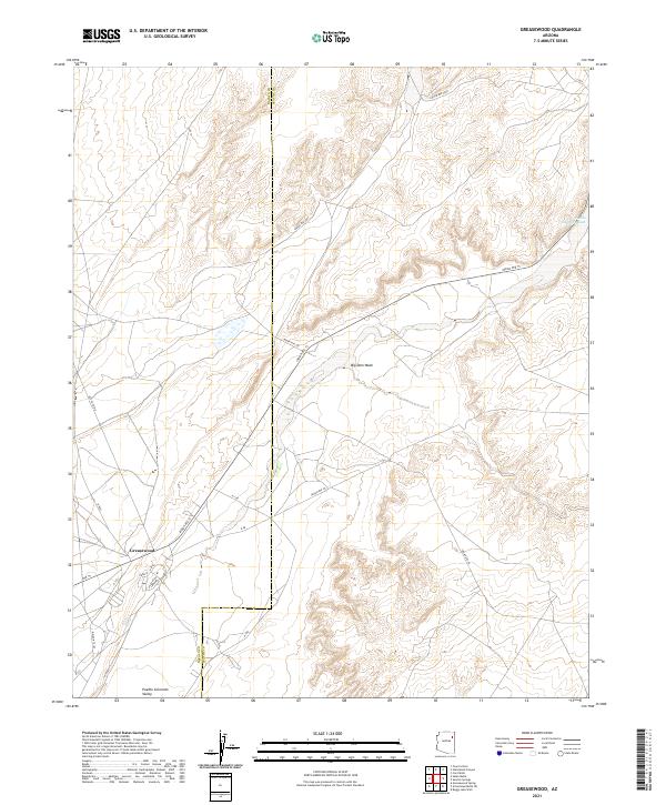
Greasewood serves as a central hub for this high-desert landscape, where the Pueblo Colorado Valley transitions through the Navajo Nation. The map illustrates a complex network of regional thoroughfares, including Indian Rte 15 and Indian Rte 9005, which follow the natural contours of the terrain. The presence of ephemeral watercourses like Big Dam Wash and the larger Pueblo Colorado Wash defines the drainage patterns of the region, illustrating the importance of water management in this arid environment.
Find a feature on this map
25 named features on this map. Tap any name to fly to it.
Don’t see what you’re looking for? This feature index may not catch every label — zoom into the map to look around manually.
Map Details
Editions of this 2021 Greasewood Map
This is the sole edition of this map. No revisions or reprints were ever made.