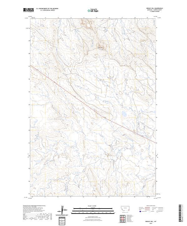
2024 Map of Greasy Hill
USGS Topo · Published 2024About this map
Greasy Hill rises as a prominent landmark in this section of Carter County, overlooking a complex drainage network that defines the regional geography. The landscape is carved by numerous waterways, including the winding paths of Wolf Creek, Camp Creek, and South Cottonwood Creek. These drainages, along with Big Grout Creek and Little Grout Creek in the northwest, suggest a territory dictated by its hydrology and natural contours rather than dense settlement.
Find a feature on this map
14 named features on this map. Tap any name to fly to it.
Don’t see what you’re looking for? This feature index may not catch every label — zoom into the map to look around manually.
Map Details
Editions of this 2024 Greasy Hill Map
This is the sole edition of this map. No revisions or reprints were ever made.
Other maps of this area

1954 · Ekalaka
USGS Topo · 1:250,000

1956 · Ekalaka
USGS Topo · 1:250,000

1958 · Ekalaka
USGS Topo · 1:250,000

1965 · Ekalaka
USGS Topo · 1:250,000
1970 · Stack Rocks
USGS Topo · 1:24,000
1970 · Hammond
USGS Topo · 1:24,000
1970 · Greasy Hill
USGS Topo · 1:24,000
1970 · Hammond SE
USGS Topo · 1:24,000

1981 · Alzada
USGS Topo · 1:100,000
1982 · Cochran Reservoir
USGS Topo · 1:24,000