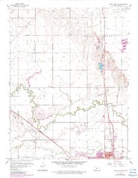
1959 Map of Great Bend NE
USGS Topo · Published 1983About this map
Great Bend serves as the focal point of this Kansas prairie landscape, situated where the Atchison Topeka and Santa Fe and Missouri Pacific railroads converge. The map documents a mid-century period of expansion, with newer purple-shaded residential footprints pushing northward from the city center toward Barton Lake. The surrounding agricultural townships of Eureka and South Homestead are dotted with legacy rural infrastructure, including School No 45 and the Walnut Valley Cem. Waterways like Walnut Creek and Blood Creek define the drainage of the plains, while the local economy is evidenced by numerous Oil Wells and Claypits. Social and recreational life of the era is captured through landmarks such as the Drive-in Theater, the Golf Course, and several local schools like Countryside Sch and Jefferson Sch.
Find a feature on this map
30 named features on this map. Tap any name to fly to it.
Don’t see what you’re looking for? This feature index may not catch every label — zoom into the map to look around manually.
Map Details
Editions of this 1959 Great Bend NE Map
3 editions found
Other maps of this area

1891 · Great Bend
USGS Topo · 1:125,000

1893 · Great Bend
USGS Topo · 1:125,000

1896 · Russell
USGS Topo · 1:125,000

1955 · Great Bend
USGS Topo · 1:250,000

1956 · Ellinwood NW
USGS Topo · 1:24,000

1957 · Great Bend
USGS Topo · 1:250,000

1957 · Ellinwood SW
USGS Topo · 1:24,000

1958 · Great Bend
USGS Topo · 1:250,000

1958 · Great Bend
USGS Topo · 1:24,000

1959 · Great Bend NE
USGS Topo · 1:24,000