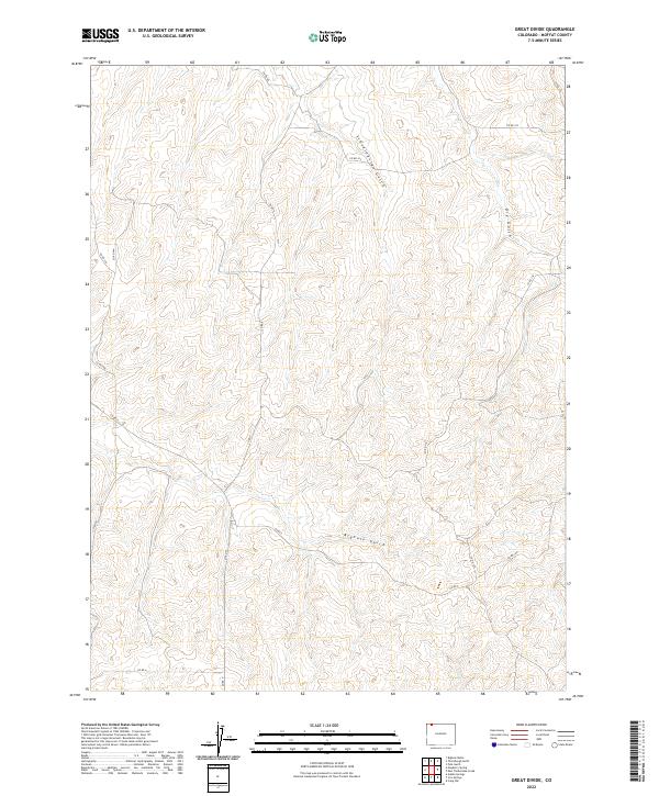
2022 Map of Great Divide
USGS Topo · Published 2022About this map
The High Plains of Moffat County, Colorado, are defined by a complex network of drainage basins and an expansive township and range grid. This survey reveals a landscape carved by seasonal waterways including Scandinavian Gulch, Dry Gulch, and the prominent Bighole Gulch which cuts across the central sections. In the southern portion of the quadrangle, Lay Cr provides a primary drainage point, reflecting the typical arid-land hydrology of the region where water flow is intermittent but influential in shaping the terrain.
Find a feature on this map
21 named features on this map. Tap any name to fly to it.
Don’t see what you’re looking for? This feature index may not catch every label — zoom into the map to look around manually.
Map Details
Editions of this 2022 Great Divide Map
This is the sole edition of this map. No revisions or reprints were ever made.
Other maps of this area

1916 · Craig
USGS Topo · 1:125,000

1954 · Craig
USGS Topo · 1:250,000

1957 · Craig
USGS Topo · 1:250,000

1958 · Craig
USGS Topo · 1:250,000

1960 · Craig
USGS Topo · 1:250,000

1962 · Craig
USGS Topo · 1:250,000

1964 · Craig
USGS Topo · 1:250,000

1965 · Craig
USGS Topo · 1:250,000
1969 · Adobe Springs
USGS Topo · 1:24,000
1969 · Great Divide
USGS Topo · 1:24,000