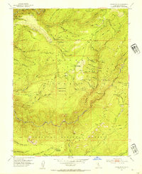
1952 Map of Greek Store
USGS Topo · Published 1954About this map
Mining operations and historical outposts dominate this Sierra Nevada landscape along the boundary of Placer Co and El Dorado Co. The map documents numerous hard-rock and placer claims scattered across the Tahoe National Forest, reflecting a legacy of gold-seeking in the American River drainage. Notable sites include the former settlement of Star Town near Grouse Creek and the French House located along the Chipmunk Trail.
Find a feature on this map
80 named features on this map. Tap any name to fly to it.
Don’t see what you’re looking for? This feature index may not catch every label — zoom into the map to look around manually.
Map Details
Editions of this 1952 Greek Store Map
4 editions found
Other maps of this area

1889 · Pyramid Peak
USGS Topo · 1:125,000

1891 · Colfax
USGS Topo · 1:125,000

1891 · Truckee
USGS Topo · 1:125,000

1891 · Placerville
USGS Topo · 1:125,000

1891 · Pyramid Peak
USGS Topo · 1:125,000

1892 · Placerville
USGS Topo · 1:125,000

1892 · Colfax
USGS Topo · 1:125,000

1893 · Placerville
USGS Topo · 1:125,000

1893 · Truckee
USGS Topo · 1:125,000

1894 · Colfax
USGS Topo · 1:125,000